The latest news is that there actually would be lots of news if there has not been extensive fixation on a couple of the hobbies of the principal posting person. It could even look like SUMMER 2009 IN REVIEW, who knows?
A synopsis, then:
The brand new Oquirrh Mountain Utah (LDS) temple (as of 21 August 2009)
There have been the customary announcements and formalities and now the new Oquirrh Mountain Utah Temple, 130th operating temple, is finally in operation. Such announcements take on a distinctly personal touch for us here at West Jordan. As of the dedication date some of us (Mom and Dad) became members of the volunteer operations staff. Our weekly scheduled time to is 1600-2200(or close) each Wednesday. This is well on its way to becoming a very welcome peaceful time each week.
Before that....
Dad visits Winter Quarters Nebraska following collapse of a business trip
If anyone is in Omaha, Nebraska, particularly at the Omaha Airport, a very splendid side trip is available
for only a modest investment in time. The Winter Quarters (aka Florence NE) LDS church history complex, including the Winter Quarters Nebraska Temple is 5 miles north (a 15 minute drive depending on route) of Omaha Eppley airport, both on the west bank of the Missouri river, which is also the Nebraska-Iowa state line.
This information collected by Dad from a visit on 16 August 2009, following the collapse of one of the HK installs in Lincoln, NE. 16 Aug is a Sunday and a couple of very pleasant afternoon hours were spent there on the temple grounds while listening by - remote cell phone link - to Mom's notes from the just barely concluded 2nd worker training meeting at Oquirrh Mountain Utah temple in West Jordan 900 miles west that same afternoon. A splendid merger of long-distance activities. Florence/Winter Quarters is well known as the last civilised staging point at the eastern end of the Mormon Pioneer trail. For some of us who are aware of ancestral connections to 19th century migration participants, this is always very poignant genetic deja-vu. Mary Williamson and Mary Wickersham Woolley (to say nothing of soon to be born daughter Mary Louisa) send their regards from the eastern trailhead.
Before that ....
Family Summer Retreat 2009 did convene, though in much abbreviated form
Yes indeed, we did get together on 6 August 2009 at Redman campground in Big Cottonwood canyon
near West Jordan. We were able to set up a phone link to the Mesa folks for the evening campfire festivities,
such as we ever have them anyway. It actually worked out as well as can be expected from the hammering it took this year from the scheduling complexity of the gang. The camp site actually was pretty cool - a double size group spot that cost us about $40 and was well worth it. If we ever do a hastily contrived ad-hoc Salt Lake solution again, it definitely will be at Redman USFS CG, Site #36 (Jumbo Double campsite). Plenty of room and oodles of parking space.
Having overnighted, we were greeted the next morning with the grim news subsequently reported elsewhere:
Marilyn and Melissa departed to obtain ad-hoc medical follow-up, Marilyn's arrest of pregnancy being then in progress. Others remained to break camp and then everyone left for various return routes to the city.
One return route was by way of the Guardsman pass road - junction within 1/2 mile of Redman CG - and a walk over
to the last hitherto unvisited minor peaks withing easy reach of Guardsman Pass. This brought the peak visit
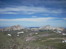
tally for Summer 2009 to 3: Jupiter Hill (9985 or something)
On the way down, Dad dropped his Tmobile cell phone in the meadow, and then rather than looking right where he
was when he dropped it (within 1/2 mile of the car), embarked on an extensive and time consuming 1/2 hour return back to the previously visited summit. So a couple of us summited a second time - for nothing. Happily, having 2 cell phones allows use of the one still on-hand to ring-locate the misplaced other one, assuming it is on. We did so, and there it was singing away happily in the trail-side grass less than 50 feet from where it was noticed missing. Mild groan.
Amongst all of that ....
How come only one or two more reports of outdoor adventures the whole summer?
The reason was that Dad was psychologically, even when not physically, gridlocked in small but very erratic
series of weekend trips away from home for occupational activities. One active project had him out one week
a month. A second project was intended to take only one weekend, but will ultimately require at least three.
Add in the planning uncertainty, and old Dad was in a complete quandary the whole time.
We were hoping to report the stunningly clever reconquest of Mount Nebo, but alas it may not be to be this season, unless miracles happen. Nevertheless, we did pack away 2 new Utah county highpoints which none of us had been to, one of them a vendetta. Amanda's rain check list grows ever longer, alas - Delano, Nebo, Timpanogos, Kings Peak, Mt Elbert, etc. A little more time in the city than we had hoped.
09 September, 2009

11 July, 2009
News from West Jordan -
This blog seems to be getting fixated on outdoor stuff and hiking.
Maybe this is OK and maybe it is not So, here is some other news. Whats new at....
Church .....
Let's see .... There will soon be a shiny new LDS temple (Oquirrh Mountain Utah) in operation in August.
The open house is in progress now and on 23 August it will be dedicated. We (Mom and Dad) have
been helping with the open house - Dad on parking and Mom inside with an ushering assignment.
We used to be on assignment at the Jordan River Temple until 10 June when our assignments there ended
in anticipation of our stake becoming a part of the temple district for the new temple.
Mom and I were recently contacted (July 1) and asked to serve as temple workers at the new Oquirrh Mountain temple following the dedication. Our assignment is once a week on Wednesday evening (4-10).
Until four years ago we both had always assumed that certain assigments were for retired people:
We never dreamed we would be asked to serve in the temple, let alone be asked to help operate
a brand new temple.
Mountain trips and other outdoor things -
Well, OK now a little tidbit on our latest trip to the mountains to hike. On July 10 we had a day of hiking in the Tushar mountain range just east of Beaver Utah.
There are some family history connections for Dad in this area - this is the home of the Barton ancestors,
including William and Mary Williamson Barton, his great-great grandparents. I have driven past Beaver
on my way to points south for years and have never noticed that there was some very nice high country
in the mountains east of town. The Tushar range is the 3rd highest mountain range in Utah, and its
highest peak - Delano Peak (12175') - is also the highest point in both Beaver and Piute counties.
So we just had to go explore. James and I both had vacation needing to be used and others had
other commitments, so just James and I went.
Beaver is far enough from Salt Lake that if the objective is a day in the high country, one pretty much
has to go in the night before and get an early start. So we went to Beaver on Thursday afternoon and stayed
over. We left lodgings at 0900 and got to the trailhead at 1000. We used State Highway 153, then Forest Service Road 123 to Big John Flat our trailhead was another 2 miles up the road from the top edge of Big John Flat,
between the Griffith creek and Poison Creek stream crossings.
The hike route was pretty direct and easy: 1.5 miles and 1600 feet gain. The route goes up a broad ridge with lots of reasonable terrain and great scenery. It also passes through some talus and other interesting features, but nothing too complicated. We arrived at the summit at 1300 and did the customary stuff we always do at the summit - snacks, pictures, etc. The summit register is in a mail box mounted on a post stuck in a rock cairn. It is pretty wierd seeing
what looks like someone's residential mailbox sitting way up there in the sticks.
After hanging around the Delano Peak summit for a little while. We decided to go get visit Mount Holly (11985) 1.5 miles away to the south on the ridge. We got there OK, but not before having to down-climb a steep inline to get down the south side of the Delano summit area. Other than that, it was just an up-and-down high tundra walk over to the
other place, but the continual loss-gain thing does get old.
After that we came back to Delano, up-climbed the steep bit, now rendered slightly less menacing by the nature of up-climbing, and a route up through the scree which we did not see coming down.
We got back down safe and sound with some pretty nice pictures. and headed down the canyon toward home.
Big John Flat is an area where there could be some camping, but it is a bit primitive for small children.
Maybe this is OK and maybe it is not So, here is some other news. Whats new at....
Church .....
Let's see .... There will soon be a shiny new LDS temple (Oquirrh Mountain Utah) in operation in August.
The open house is in progress now and on 23 August it will be dedicated. We (Mom and Dad) have
been helping with the open house - Dad on parking and Mom inside with an ushering assignment.
We used to be on assignment at the Jordan River Temple until 10 June when our assignments there ended
in anticipation of our stake becoming a part of the temple district for the new temple.
Mom and I were recently contacted (July 1) and asked to serve as temple workers at the new Oquirrh Mountain temple following the dedication. Our assignment is once a week on Wednesday evening (4-10).
Until four years ago we both had always assumed that certain assigments were for retired people:
We never dreamed we would be asked to serve in the temple, let alone be asked to help operate
a brand new temple.
Mountain trips and other outdoor things -
Well, OK now a little tidbit on our latest trip to the mountains to hike. On July 10 we had a day of hiking in the Tushar mountain range just east of Beaver Utah.
There are some family history connections for Dad in this area - this is the home of the Barton ancestors,
including William and Mary Williamson Barton, his great-great grandparents. I have driven past Beaver
on my way to points south for years and have never noticed that there was some very nice high country
in the mountains east of town. The Tushar range is the 3rd highest mountain range in Utah, and its
highest peak - Delano Peak (12175') - is also the highest point in both Beaver and Piute counties.
So we just had to go explore. James and I both had vacation needing to be used and others had
other commitments, so just James and I went.
Beaver is far enough from Salt Lake that if the objective is a day in the high country, one pretty much
has to go in the night before and get an early start. So we went to Beaver on Thursday afternoon and stayed
over. We left lodgings at 0900 and got to the trailhead at 1000. We used State Highway 153, then Forest Service Road 123 to Big John Flat our trailhead was another 2 miles up the road from the top edge of Big John Flat,
between the Griffith creek and Poison Creek stream crossings.
The hike route was pretty direct and easy: 1.5 miles and 1600 feet gain. The route goes up a broad ridge with lots of reasonable terrain and great scenery. It also passes through some talus and other interesting features, but nothing too complicated. We arrived at the summit at 1300 and did the customary stuff we always do at the summit - snacks, pictures, etc. The summit register is in a mail box mounted on a post stuck in a rock cairn. It is pretty wierd seeing
what looks like someone's residential mailbox sitting way up there in the sticks.
After hanging around the Delano Peak summit for a little while. We decided to go get visit Mount Holly (11985) 1.5 miles away to the south on the ridge. We got there OK, but not before having to down-climb a steep inline to get down the south side of the Delano summit area. Other than that, it was just an up-and-down high tundra walk over to the
other place, but the continual loss-gain thing does get old.
After that we came back to Delano, up-climbed the steep bit, now rendered slightly less menacing by the nature of up-climbing, and a route up through the scree which we did not see coming down.
We got back down safe and sound with some pretty nice pictures. and headed down the canyon toward home.
Big John Flat is an area where there could be some camping, but it is a bit primitive for small children.
27 June, 2009
West Jordan 2009 Hike opening event
Looks like some folks at West Jordan continue to be fixated on hikes in general and peak-bagging specifically. We try to keep it within reason, I suppose, and boredom is still an option.
The news item for this post is that Willard Peak, incomplete from 22 September 2008, has been wrestled into submission as of 26 June 2009.
Where the heck is Willard Peak ? Next trip to Brigham City, UT via Ogden, UT on I-15, look up and
to the right (NorthEast) and there will be another section of the Wasatch. The high bump to the left of the group is Willard Peak. The bump to the right is Ben Lomond Peak. Ben Lomond is popular, Willard is higher, hence our target.
Here are the essentials
[Equipment]: We used a rented GMC Acadia to get to our improvised "trailhead"
[Hike start point] This route starts for us at a road turnout 6.5 miles up the Willard Peak road
which we shall call the "Perry Reservoir Monster Pumpkin Cracker Event Horizon". The road legend graphics actually do change at that point on the topo map. The road itself goes from
diminishing quality car/truck road to ATV playground.
The route is 3 miles longer each way because we never attempted to take a vehicle all the way to Willard Basin campground; We have seen vehicles that make it, but we do not own one such. Choices are: (1) ATV, (2) Monster high clearance pickup we do not mind scratching up.
[Hike elapsed times] Start 1245, End 2100, Time 8:15
[Road Segments] (1) Perry to Willard basin overlook - multiple switchback road, (2) Willard overlook to Willard basin campground - straight sloping segment down into the basin with a curve to the west at the end.
[Attempted Variations]
James looked at segment 2 and decided to try NOT losing and regaining altitude on the way to
the top (south end) of Willard Basin. He and Amanda tried a ridge route with limited success.
Others (Dad) just used the road... boring but less annoying complexity. The original intent was
try both and keep one for the return. The ridge showed some goofy side effects (traverse of 70 degree incline with snow on it, for example) and was eventually discarded. Got to use the radios, though. This only cost 30 minutes past Dad's slower time on the road.
[The Snow] We pre-inspected the summit conditions from the valley floor and everything looked clear and dry. North and East facing slopes are hidden from valley and this is quite a ways north....
So there actually a number of isolated patches of left over snow where we could not see:
On Willard Basin south end/campground area, on the road and on lots north and east facing slopes of Willard Peak northwest ridge(alias south basin headwall), notably including Amanda's fun chimney to northeast ridge from the time before.
[Other assorted method variations]
With all the snow there still was a completely workable modified route up the normally obvious and easy northwest ridge route to the north of the summit area. It did require us to flagrantly commit the
great unforgivable sin of all responsible hiking .... Shortcutting of switchbacks.
The subsequent route onto the summit outcrop was actually relatively obvious and easy.
Once on the summit outcrop the route turns slightly troublesome again.....
The summit itself is fractured and exposed in spots. Much rock hopping and exposure skirting engaged in. Dad was on his own, others having gone ahead.
[The summit ritual] Summit at 1715-1745 depending on who one was. Much high-fiving and group-hugging engaged in. Also many declarations of the one-time-ness of the route, with identification of the grungier elements of same.
[A thought provoking descent]
As soon as we were safely off the summit, a squall hit summit and ridge - horizontal sleet, etc.
Good thing we insisted that Amanda take an adequate shell. She used it this time.
Our photo footage shows indications of the squall rolling in.
[Down-hike death march] The road section just before Willard overlook was the death march we knew it would be. A one-timer within a one-timer, except that for one of us (ME) it was the 4th time. We congratulate ourselves after doing such things, which is the only consolation for how rotten we feel during them. Dreadfully anti-climactic after the psycho-high we get from pushing ourselves to the limit during the up-hike. No medal, just something dumb one has to do.
[Remaining get the heck out] What's to tell .... Just back to the car.... other than being asked by ATVers if we would be OK walking that far. One is tempted to point out that based on past experience, the seasoned pedestrians are not the ones in jeopardy.
The news item for this post is that Willard Peak, incomplete from 22 September 2008, has been wrestled into submission as of 26 June 2009.
Where the heck is Willard Peak ? Next trip to Brigham City, UT via Ogden, UT on I-15, look up and
to the right (NorthEast) and there will be another section of the Wasatch. The high bump to the left of the group is Willard Peak. The bump to the right is Ben Lomond Peak. Ben Lomond is popular, Willard is higher, hence our target.
Here are the essentials
[Equipment]: We used a rented GMC Acadia to get to our improvised "trailhead"
[Hike start point] This route starts for us at a road turnout 6.5 miles up the Willard Peak road
which we shall call the "Perry Reservoir Monster Pumpkin Cracker Event Horizon". The road legend graphics actually do change at that point on the topo map. The road itself goes from
diminishing quality car/truck road to ATV playground.
The route is 3 miles longer each way because we never attempted to take a vehicle all the way to Willard Basin campground; We have seen vehicles that make it, but we do not own one such. Choices are: (1) ATV, (2) Monster high clearance pickup we do not mind scratching up.
[Hike elapsed times] Start 1245, End 2100, Time 8:15
[Road Segments] (1) Perry to Willard basin overlook - multiple switchback road, (2) Willard overlook to Willard basin campground - straight sloping segment down into the basin with a curve to the west at the end.
[Attempted Variations]
James looked at segment 2 and decided to try NOT losing and regaining altitude on the way to
the top (south end) of Willard Basin. He and Amanda tried a ridge route with limited success.
Others (Dad) just used the road... boring but less annoying complexity. The original intent was
try both and keep one for the return. The ridge showed some goofy side effects (traverse of 70 degree incline with snow on it, for example) and was eventually discarded. Got to use the radios, though. This only cost 30 minutes past Dad's slower time on the road.
[The Snow] We pre-inspected the summit conditions from the valley floor and everything looked clear and dry. North and East facing slopes are hidden from valley and this is quite a ways north....
So there actually a number of isolated patches of left over snow where we could not see:
On Willard Basin south end/campground area, on the road and on lots north and east facing slopes of Willard Peak northwest ridge(alias south basin headwall), notably including Amanda's fun chimney to northeast ridge from the time before.
[Other assorted method variations]
With all the snow there still was a completely workable modified route up the normally obvious and easy northwest ridge route to the north of the summit area. It did require us to flagrantly commit the
great unforgivable sin of all responsible hiking .... Shortcutting of switchbacks.
The subsequent route onto the summit outcrop was actually relatively obvious and easy.
Once on the summit outcrop the route turns slightly troublesome again.....
The summit itself is fractured and exposed in spots. Much rock hopping and exposure skirting engaged in. Dad was on his own, others having gone ahead.
[The summit ritual] Summit at 1715-1745 depending on who one was. Much high-fiving and group-hugging engaged in. Also many declarations of the one-time-ness of the route, with identification of the grungier elements of same.
[A thought provoking descent]
As soon as we were safely off the summit, a squall hit summit and ridge - horizontal sleet, etc.
Good thing we insisted that Amanda take an adequate shell. She used it this time.
Our photo footage shows indications of the squall rolling in.
[Down-hike death march] The road section just before Willard overlook was the death march we knew it would be. A one-timer within a one-timer, except that for one of us (ME) it was the 4th time. We congratulate ourselves after doing such things, which is the only consolation for how rotten we feel during them. Dreadfully anti-climactic after the psycho-high we get from pushing ourselves to the limit during the up-hike. No medal, just something dumb one has to do.
[Remaining get the heck out] What's to tell .... Just back to the car.... other than being asked by ATVers if we would be OK walking that far. One is tempted to point out that based on past experience, the seasoned pedestrians are not the ones in jeopardy.
So... Lot's of fun, but the group is glad to be done with it.
18 May, 2009
A few new items at West Jordan
It is quite some time from February until May. It must have gotten busy. It also may have something to do with issues uploading photographs, which kills enthusiasm to post somewhat.
Here are some highlights.....
March ..... We took one or two more showshoe trips and then got busy elsewhere.
April ..(14..)... Both of the ancient ones drove to Phoenix to see Joshua, Julie and the boys. G-Mom C. wanted to try out the Flagstaff route. Not too bad in spring, and shorter. The Phoenix folk mysteriously had pictures of G-Mom but GDadson actually was there briefly before heading back to SLC by air.
April ..(29)... there was a startling incident in downtown SLC in which the venerable Blue 96 GMC Safari van was suddenly rendered unusable. After 13 years of reliable transport, the owners were thrown abruptly into making other arrangements. Images of the crunched car would probably be too depressing, though I do have a profusion thereof, but I shall refrain for the time being.
May ...(3)... A suitable substitute was located at an interesting registered vendor near downtown SLC -- yet another instance of like model, so we are contentedly situated once again in a 2000 GMC Safari for the time being. I would post images of the new bird, but I am being lazy.
The seller is a sibling business of one of the local Airport shuttle franchises and they have operated the Astro/Safari platform for several years. It was interesting to deal with a fellow fleet operator - we just never thought of ourselves as "Fleet operators". Hmmm.
Official Vehicle Fleet color update: The official Clark fleet exterior color seems to have shifted from BLUE to SILVER ... and taken several other vehicles with it... to wit...
Melissa replaced her Blue 96 Tracker with a Silver (2005?)Tracker, following her recent total loss collision.
Only the 2002 Venture (LA family maintenance vehicle) remains Blue.
May ... (19) ... MomBeing recently brokered yet another arrangement for an updated (2003) Ford Windstar and it was, by coincidence also ..... Silver (or variant called Pewter)
May ...(18-22)... Dadson visited HK Systems Milwaukee WI office to get some pertinent technical info in preparation for an upcoming refit project at the brewery of yore at Columbus, OH, whence he is also headed on 18-22 June.
That's all for now unless I think of something else
Here are some highlights.....
March ..... We took one or two more showshoe trips and then got busy elsewhere.
April ..(14..)... Both of the ancient ones drove to Phoenix to see Joshua, Julie and the boys. G-Mom C. wanted to try out the Flagstaff route. Not too bad in spring, and shorter. The Phoenix folk mysteriously had pictures of G-Mom but GDadson actually was there briefly before heading back to SLC by air.
April ..(29)... there was a startling incident in downtown SLC in which the venerable Blue 96 GMC Safari van was suddenly rendered unusable. After 13 years of reliable transport, the owners were thrown abruptly into making other arrangements. Images of the crunched car would probably be too depressing, though I do have a profusion thereof, but I shall refrain for the time being.
May ...(3)... A suitable substitute was located at an interesting registered vendor near downtown SLC -- yet another instance of like model, so we are contentedly situated once again in a 2000 GMC Safari for the time being. I would post images of the new bird, but I am being lazy.
The seller is a sibling business of one of the local Airport shuttle franchises and they have operated the Astro/Safari platform for several years. It was interesting to deal with a fellow fleet operator - we just never thought of ourselves as "Fleet operators". Hmmm.
Official Vehicle Fleet color update: The official Clark fleet exterior color seems to have shifted from BLUE to SILVER ... and taken several other vehicles with it... to wit...
Melissa replaced her Blue 96 Tracker with a Silver (2005?)Tracker, following her recent total loss collision.
Only the 2002 Venture (LA family maintenance vehicle) remains Blue.
May ... (19) ... MomBeing recently brokered yet another arrangement for an updated (2003) Ford Windstar and it was, by coincidence also ..... Silver (or variant called Pewter)
May ...(18-22)... Dadson visited HK Systems Milwaukee WI office to get some pertinent technical info in preparation for an upcoming refit project at the brewery of yore at Columbus, OH, whence he is also headed on 18-22 June.
That's all for now unless I think of something else
27 February, 2009
West Jordan plays in snow at Brighton - Milly section
This will not have pictures. It was to have been short as well. So much for short.
More snow hiking since the last post and probably more after this one as we continue to rope people in by making foot equipment appear at the correct times. All the trips so far have been at Brighton Ski Resort, Big Cottonwood Canyon, east of Sandy, UT. That is all we dare to do right now - I am not sure what we would be into risk-wise right now if we went off into remote territory, and concern about risk tends to diminish the fun. Maybe someday. This really is all about how not to be CRABBY about everything but a little slice of summer. By doing outdoor stuff during more of the year, we reduce the likelihood that Dadson will be quite so crabby about other activities in the summer. The only time that is not really usable for outdoor now is the spring when the snow is horribly inconsistent and therefore totally in the way of non-snow foot travel.
I will now stop right here and make a couple of correlations of Summer vs Winter place names... Ready? OK
We have now found out by trial and error what all the skiers probably know already - that the runs served by the Majestic (Quad), Crest, and Explorer Lifts are lighted at night. So by extension, the resort does not care that they have various people running around in those areas event until evening, and there are a lot of people so they cannot possibly keep track of them all and therefore, one is left alone to wander.
We say this because we had different results when we tried the Millicent area on this last trip. See above note regarding lack of lighting, hence no Night Skiing at Milly. Since there is no night skiing they close the mountain at 1700. By extension they appear to want to kick everyone off the mountain; We were not all that sure about the actual possibility of this close the mountain thing -- How does one do that? It is big, it is out of doors. it is on Forest Service territory, which is Public land ... It is .. well, A mountain, sort of. Apparently this kicking users off is meant to pass for this close the mountain thing , I surmise..... Also, staff at Millicent Base Lift station are what James describes as TERRITORIAL. So, in a word, we were nibbled to death by resort personnel at various intervals:
At the lift boarding area by lift operations people,
Near the top of the hill by ski patrol, and
by the hinting presence of a SnowCat with engine running further up.
We did get to Twin Lake dam. Mt Evergreen would have been too much risky snow due to slope or we would have done it.
The route was straight up the hill at a high angle and we toe kicked a whole lot. The cleats (actually called crampons by the MSR folks) were indispensable and imperative on this trip. It was a massive workout - it got James tired and that is saying something. It was nevertheless still very COOL in my view. By the time we got to the top, James was tired and weary of the nibbling (comments like "you have to go way over there on the unsafe snow away from our ski run", and "when I ski down there will be no one above me or you and you will be on your own" ("We hang round up here profusely in Summer, know our way round and are profusely equipped" says James), and finally "Rumble, rumble, rumble, putt, putt, humm, whirr - approximately the sound made by the SnowCat as its driver says nothing directly but hints by its presence for the walkers to GO AWAY so that the SnowCat can do whatever it is up there to do - we never found out - perhaps the run needed grooming.
So we touched the Dam, took a few camera shots (which we for some reason cannot upload, sorry) and got the heck down.
I originally projected that this post would be short in addition to not having pictures. Apparently I cannot write anything short, I guess. There nevertheless are no pictures.
And there it is... The endeavor convenes on the next Saturday with good weather....
More snow hiking since the last post and probably more after this one as we continue to rope people in by making foot equipment appear at the correct times. All the trips so far have been at Brighton Ski Resort, Big Cottonwood Canyon, east of Sandy, UT. That is all we dare to do right now - I am not sure what we would be into risk-wise right now if we went off into remote territory, and concern about risk tends to diminish the fun. Maybe someday. This really is all about how not to be CRABBY about everything but a little slice of summer. By doing outdoor stuff during more of the year, we reduce the likelihood that Dadson will be quite so crabby about other activities in the summer. The only time that is not really usable for outdoor now is the spring when the snow is horribly inconsistent and therefore totally in the way of non-snow foot travel.
I will now stop right here and make a couple of correlations of Summer vs Winter place names... Ready? OK
- There are actually two sections at Brighton: Millicent and Majestic
- Majestic section is the big main area served by the Majestic, Crest, Explorer Lift system
- Majestic section adjoins the Lake Mary/Martha/Catherine basin and also SnakeCreek and Clayton
- Mt Majestic in Winter is Clayton Peak in Summer
- The unsused Lift equipment above the Lake Mary Trail in Summer belongs to the Crest Lift and run system
- The Crest Lift area is what we now call the Freeway.
- There actually is a traverse run called Lower Mary. I think that is the one we use to get to Dog lake.
- The Crest Lift goes to the Snake Creek Pass area except that the skiers do not call it that.
- The whole SHE-BANG is lighted at night and much used
- The Millicent section is the side area adjacent to the NorthWest of the parking lot, aka the Twin Lake basin
- Mt Millicent and Mt Evergreen are the same in Summer and Winter
- Since Twin Lakes is covered in snow it is out of area boundary and not identified to skiers
- The Twin Lakes trail is the main Millicent ski run system, covered with 6-8 feet of snow
- The Area is NOT lighted at night and so closes at dusk for skiing.
We have now found out by trial and error what all the skiers probably know already - that the runs served by the Majestic (Quad), Crest, and Explorer Lifts are lighted at night. So by extension, the resort does not care that they have various people running around in those areas event until evening, and there are a lot of people so they cannot possibly keep track of them all and therefore, one is left alone to wander.
We say this because we had different results when we tried the Millicent area on this last trip. See above note regarding lack of lighting, hence no Night Skiing at Milly. Since there is no night skiing they close the mountain at 1700. By extension they appear to want to kick everyone off the mountain; We were not all that sure about the actual possibility of this close the mountain thing -- How does one do that? It is big, it is out of doors. it is on Forest Service territory, which is Public land ... It is .. well, A mountain, sort of. Apparently this kicking users off is meant to pass for this close the mountain thing , I surmise..... Also, staff at Millicent Base Lift station are what James describes as TERRITORIAL. So, in a word, we were nibbled to death by resort personnel at various intervals:
At the lift boarding area by lift operations people,
Near the top of the hill by ski patrol, and
by the hinting presence of a SnowCat with engine running further up.
We did get to Twin Lake dam. Mt Evergreen would have been too much risky snow due to slope or we would have done it.
The route was straight up the hill at a high angle and we toe kicked a whole lot. The cleats (actually called crampons by the MSR folks) were indispensable and imperative on this trip. It was a massive workout - it got James tired and that is saying something. It was nevertheless still very COOL in my view. By the time we got to the top, James was tired and weary of the nibbling (comments like "you have to go way over there on the unsafe snow away from our ski run", and "when I ski down there will be no one above me or you and you will be on your own" ("We hang round up here profusely in Summer, know our way round and are profusely equipped" says James), and finally "Rumble, rumble, rumble, putt, putt, humm, whirr - approximately the sound made by the SnowCat as its driver says nothing directly but hints by its presence for the walkers to GO AWAY so that the SnowCat can do whatever it is up there to do - we never found out - perhaps the run needed grooming.
So we touched the Dam, took a few camera shots (which we for some reason cannot upload, sorry) and got the heck down.
I originally projected that this post would be short in addition to not having pictures. Apparently I cannot write anything short, I guess. There nevertheless are no pictures.
And there it is... The endeavor convenes on the next Saturday with good weather....
Subscribe to:
Posts (Atom)